Build Maps
Efficiently

N Vision provides state-of-the-art and AI-powered geospatial software solutions to efficiently map and monitor areas of interest using satellite and aerial imagery.

Our AI-powered geospatial software solutions allow to build and update maps at human-level accuracy up to 6x more cost- and time efficient compared to traditional approaches.

Cost & Time Efficiency

Cost & Time Efficiency
Unleash the power of N Vision’s AI-driven geospatial solutions to achieve results up to 6x faster and at a fraction of the traditional costs. Streamline your mapping processes without compromising accuracy.

High-Quality & Up-to-Date

High-Quality & Up-to-Date
Elevate your decision-making with accurate and consistently updated geospatial data. N Vision ensures your information is always current, providing a reliable foundation for your strategic insights.

Adapted to Your Needs

Adapted to Your Needs
Tailor your geospatial experience with N Vision’s customizable solutions. We help to adapt our solutions to the unique requirements of your projects, ensuring optimal outcomes.

Ease-Of-Access

Ease-Of-Access
N Vision’s data hosting services enable you to access your raster and vector data from anywhere, at any time. Experience the flexibility to manage and monitor your area of interest at your terms.

Products

Explore N Vision’s diverse range of cutting-edge geospatial products, meticulously designed to revolutionize the way you map, monitor and manage areas of interest.

From AI-powered mapping for precision insights to an intuitive AI-assisted map editor and seamless data processing, our comprehensive suite provides efficiency, accuracy and adaptability tailored to your unique requirements.
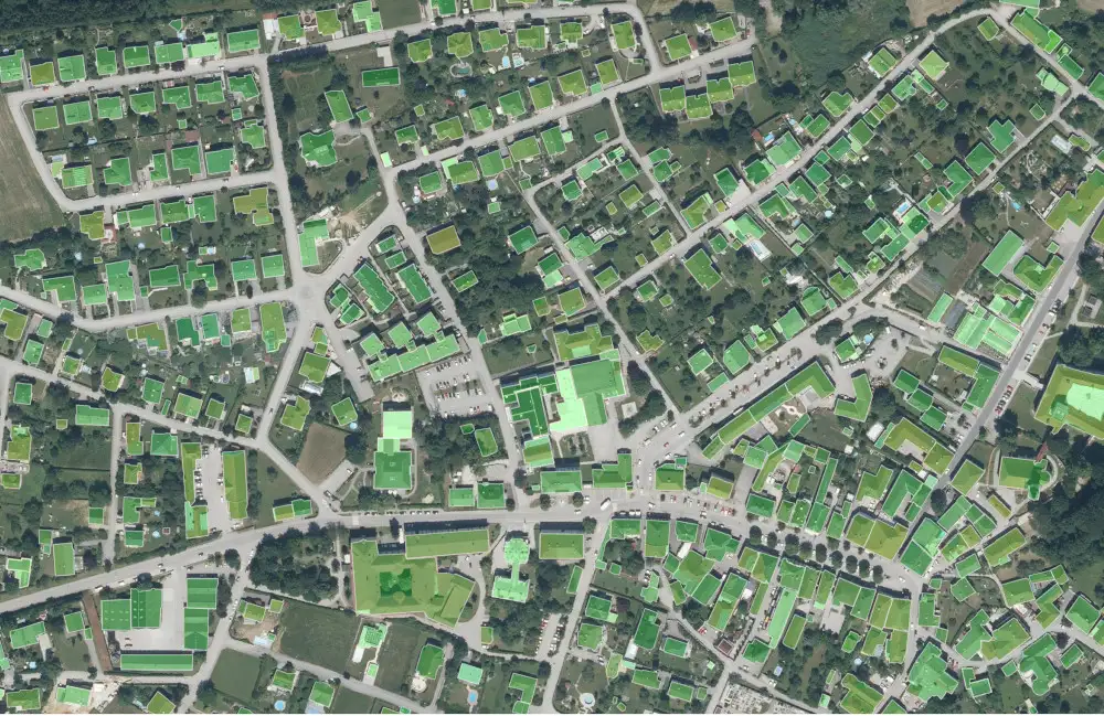
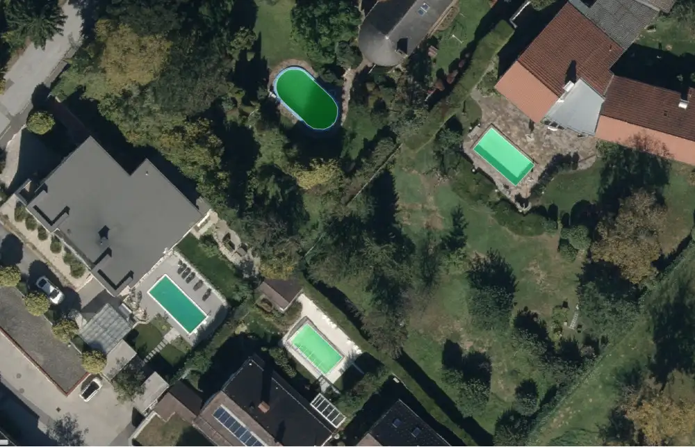
Building Outline Detection
Solar Panel Detection
Lane Marking Detection
Swimming Pools Detection

AI-Powered Mapping

Make use of N Vision’s geospatial AI models to automatically map and monitor your areas of interest at scale.

We offer ready-to-use AI models as well as custom detection models to target your specific needs.

Get in touch to learn more about available models, custom detection and accuracy expectations.

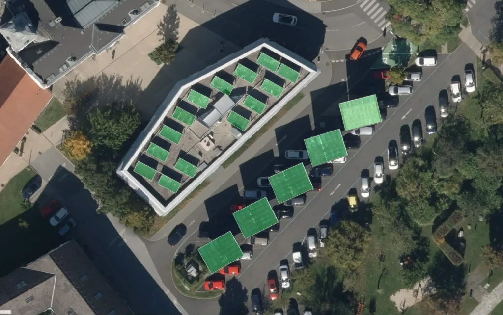
AI-Assisted Map Editor

N Vision’s AI-assisted and interactive user interface enables efficient map data extraction at human-level accuracy from satellite and aerial images.

Our AI-assisted features speed up mapping and verification tasks significantly compared to traditional approaches.

Additionally, mapping tasks can be distributed across a team to further speedup delivery times.

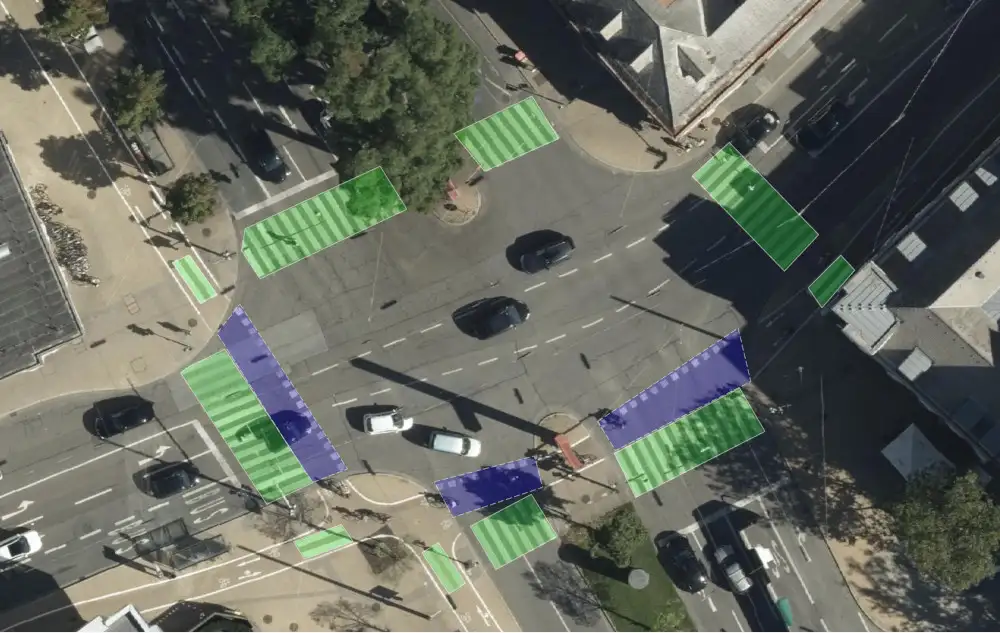
AI-powered Monitoring

“The only constant is change.” Once having created a map, the next step is to keep it updated because of our ever changing world.

Using ortho imagery captured at intervals and our AI-powered mapping solutions, we provide information about where and which objects of interest changed.

Curious about how your region of interest is changing over time?

Data Processing

Data Processing
Leverage N Vision’s advanced geospatial data processing pipeline, capable of automatically analyzing vast areas of interest worldwide. Enhance your workflow with automated predictions, ensuring your data is processed accurately and efficiently.

Data Hosting

Data Hosting
Unlock the power of global accessibility with N Vision’s data hosting service. Safeguard and access your raster and vector data securely from anywhere at any time. Experience unparalleled flexibility in managing and monitoring your geospatial data.

API

API
Empower your applications with N Vision’s API, seamlessly integrating our state-of-the-art geospatial services. Unlock the potential of AI-driven mapping and monitoring within your own software environment, fostering innovation and efficiency.

Services

N Vision goes beyond providing cutting-edge software solutions. Our expert services complement our technology, offering personalized consulting, custom solutions, efficient labeling services.

Consulting

Consulting
Benefit from our extensive experience in building automated mapping solutions using AI and state-of-the-art computer vision techniques.

Solutions

Solutions
Our computer vision solutions for aerial and satellite imagery can be designed specifically for your needs

Labeling

Labeling
Our mapping team supports you in efficiently verifying and mapping large areas using our AI-powered tools.

Proudly supported by

Ready to discuss your project? We'd love to hear from you! Let’s talk about how we can collaborate.